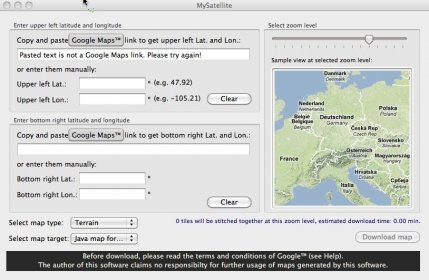
This application can automatically download and stitch together any type of Google Maps tiles (road, terrain or satellite) into one high resolution image. The stitched map is a jpg file, that can be printed out easily. The downloaded tiles can be used in a Java enabled Mobile phone (Sony Ericsson, Samsung, Nokia phones). The phone application can zoom in and out, and uses the original tiles for fast display.


Comments