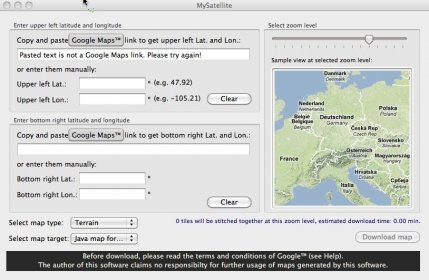
Work with different images and coordinates from satellite readings and global maps. Combine content from two different points displayed as parts of a high-resolution image. Import and export the data to and from maps compatible with GPS devices, including mobile phones.
MySatellite can download and combine every map, terrain or satellite tile between two chosen Earth coordinates into one high resolution image.
Downloaded maps can be printed or exported to your Java (J2ME) enabled mobile phone (newer Sony Ericsson, Nokia, Sagem, Samsung, Motorola, LG phones support it).

Comments