v1.2 [Jun 9, 2010]
- WFS access is read only. No changes are saved to the server.
- WFS client retrieves too much data in some queries.
- WFS client requests data in WGS84 (CRS84). Changes:
- Fixed bug in GCP and Geotransform handling which caused non-US number formats to be interpreted incorrectly (specifically ',' as a decimal was being taken as the end of the number)
- Illustrator Export now uses the Page Setup orientation and page size
- Illustrator Export's scale now uses CM or Inches based on the prevailing language/locale settings
- Support for always showing labels for features (on a style basis)
- Fixed bug (introduced in 1.2.9b2) which caused inaccurate scale bars to be created in Illustrator Export
- Fixed bug which could result in labels not drawing in certain fonts and sizes
- Emoji characters now rendered as symbols instead of leaving a blank
- Fixed KML export bug which could result in problems with Google Fusion Tables
- Fixed bug in KML export of polygons with holes so that they are now appropriately represented
- Fixed a bug which could cause polygons with holes to be exported to GML as multipolygons
- Fixed a bug which caused NFR keys not to work when entered under most circumstances.
- Fixed bug where licensing window could be brought up while it was already up.
- Use internal ODBC so that MDB import and odbc calls work for 10.8
- Added resolution controls to Illustrator Export for bitmaps.
- Added Projection name to exported Illustrator files
- Added Scale to Illustrator export ( 1 inch, N units, and scale ratio)
- By default images exported to Illustrator do not contain bitmaps that expand outside of the visible page. The old "flood" method can be restored by using the new option in the export window.
- Emoji characters now rendered as symbols instead of leaving a blank
- Illustrator Export's scale now uses CM or Inches based on the prevailing language/locale settings
- Illustrator Export now uses the Page Setup orientation and page size
- Support for always showing labels for features (on a style basis)
- Added resolution controls to Illustrator Export for bitmaps.
- Added Projection name to exported Illustrator files
- Added Scale to Illustrator export ( 1 inch, N units, and scale ratio)
- By default images exported to Illustrator do not contain bitmaps that expand outside of the visible page. The old "flood" method can be restored by using the new option in the export window. Bug fixes:
- Fixed bug which could result in labels not drawing in certain fonts and sizes
- Fixed KML export bug which could result in problems with Google Fusion Tables
- Fixed bug in KML export of polygons with holes so that they are now appropriately represented
- Fixed a bug which could cause polygons with holes to be exported to GML as multipolygons
- Fixed a bug which caused NFR keys not to work when entered under most circumstances.
- Fixed bug where licensing window could be brought up while it was already up.
- Use internal ODBC so that MDB import and odbc calls work for 10.8
- Fixed bug in GCP and Geotransform handling which caused non-US number formats to be interpreted incorrectly (specifically ',' as a decimal was being taken as the end of the number)
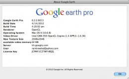
Google Earth Pro gives advanced business tools in addition to all the easy-to-use features and imagery of Google Earth.
Small utility that allows you to quickly typeset LaTeX equations, without bothering with file creation, preambles, and so on.