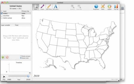
Magic Maps is an innovative tool for analyzing time-series data on a map. Simply drag in a data file (or download an example map from the Gallery) and start working with your information in a whole new way.
Maps. From the moment you import some data, states and countries immediately light up according to values of interest. And if you like, simply click the map legend to customize the colors and the numeric ranges that they represent. Or, assign colors based on text fields. Within the blink of an eye, Magic Maps gives you the high-level, full-color snapshot that you've been looking for.
Comments