HoudahGeo lets you know where you took that photo!
With HoudahGeo you may "pin" photos to locations where they were taken.
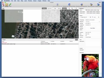
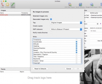
Just like an expensive GPS camera, HoudahGeo may store latitude, longitude and altitude information right within the image file - invisibly with no loss of quality. HoudahGeo writes EXIF, XMP and IPTC tags.
HoudahGeo also lets you to share your geotagged photos in Google Earth or publish them to Flickr, Locr or EveryTrail.com.One-stop geocoding for the Mac
HoudahGeo caters to two very different needs:
- Geocoding for archival purposes using EXIF, XMP and IPTC tags
- Geocoding for publishing to Google Earth or Flickr (GPS device: optional)
HoudahGeo offers you many ways of geocoding your favorite photos:
- Automatic: Matches photos to GPS track logs and waypoints
- iPhone: Matches photos to reference photos taken using iPhone
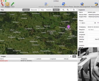
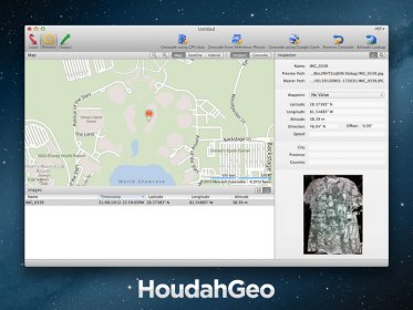
- Using a Google Earth: Point to the desired location
- Using a map: Pick locations using the built-in map
- Precision: Attach photos to GPS waypoints
- Manual: Enter coordinates found on Google Earth, Wikipedia (GPS device: supported)
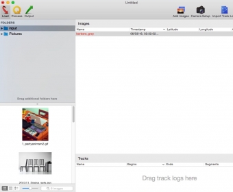
HoudahGeo connects directly to many brands and models of GPS track loggers. It also reads GPX and NMEA files created by third party software.


Comments