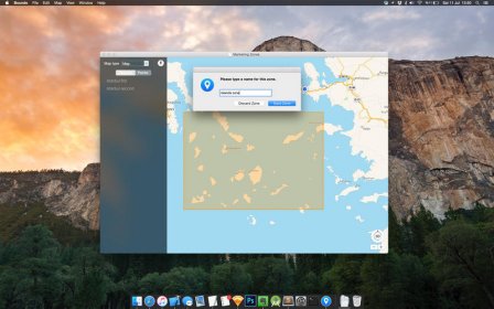
Bounds is a simple tool to mark rectangular zones on world maps. You can import GPX positions, draw zones, name them, and export them in virtually any text-based format. It's a tool for generating areas of interest visually, and exporting to any format for another program to read. Sample uses include analysis, zone generation, and preparing files for location-based automation systems.


Comments