Mac
Mac
Windows
Log in / Sign up
Mac
›
Tags
›
GPS activities
Featured
GPS Activities
Software
Relevance
Popularity
Rating
iMyFone AnyTo
460
iMyfone Technology Co., Ltd.
iMyFone AnyTo helps you change the GPS...
helps you change the
GPS
location
ContentManager
free
192
MiTAC International Corporation
Content Manager is an application that synchs with your Magellan GPS navigator...
synchs with your Magellan
GPS
navigator
Dashcam Viewer
103
Earthshine Software
Dashcam Viewer is an application for viewing sequential dashcam videos and associated GPS...
dashcam videos and associated
GPS
data. With Dashcam
Ascent
free
72
Montebello Software LLC.
Ascent allows runners, hikers and cyclists to manage and thoroughly analyze their activities with the help of GPS...
analyze their
activities
with the help of
GPS
recorded
MacENC
53
GPSNavX
MacENC is the professional solution for the mariner that wants to take...
Softcharts. Plug your
GPS
into your Mac...and charting new destinations. A
GPS
is not required
GCompris
38
Bruno Coudoin
GCompris is a high quality educational software suite comprising of numerous activities for children aged...
comprising of numerous
activities
for children aged...comprising of numerous
activities
for children
FlexTime
37
Red Sweater Software
FlexTime is a timer for repetitive activities. Use it for scheduling your workday activities...
scheduling your workday
activities
, stretch breaks...routine of timed
activities
and assign
Rand McNally Dock
free
30
Rand McNally
The Rand McNally Dock is an essential part of your Rand McNally GPS device...
of your Rand McNally
GPS
device. It provides
GPSAssist Update
free
30
Google Project Hosting
GPSAssist Update - Updates GPSAssist-data for Sony GPS-enabled camera on Mac OS X 10.5+ . The goal of this project...
GPSAssist-data for Sony
GPS
-enabled camera on Mac...data on their Sony
GPS
-enabled camera (DSC-HX5V
QLandkarte GT
free
29
Oliver Eichler
QLandkarte GT is the ultimate outdoor aficionado's tool. It supports GPS maps...
tool. It supports
GPS
maps in GeoTiff...you think your Magellan
GPS
GolfLogix
free
23
GolfLogix, Inc.
This is an app for Golf on your phone. With GolfLogix you get...
GolfLogix you get: precise
GPS
distances on 30,000
MesaExif
9
Hirofumi Kuramoto
MesaExif is an easy-to-use and powerful Meta Data processor. Main features: - View and edit Exif...
and edit Exif, ExifAUX,
GPS
, IPTC, JFIF ...set the coordinates to
GPS
dictionary. You can
WiFinder
8
Kallaxa Software
WiFinder helps you scan, graph, and GPS map WiFi networks. Using advanced GPS...
scan, graph, and
GPS
map WiFi networks...Using advanced
GPS
technology, WiFinder scans
vmAIS
free
7
Vesper Marine Ltd.
vmAIS is an installation and configuration tool for your Vesper Marine AIS transponder...
Transponder's own
GPS
position, position accuracy...and speed, configure
GPS
smoothing, fast updates
Photo GEO Tagger
4
IDimager Systems, Inc.
Photo GEO Tagger helps you add GPS coordinates to your photos, copy/paste GEO information...
Tagger helps you add
GPS
coordinates...Tagger to delete existing
GPS
and/or location
Polar HRM to GPX Merger
free
4
TracksBox.net
This little utility program helps to merge altitude data from Polar HRM activity file to Polar GPX...
data from Polar HRM
activity
file to Polar GPX...recorded from Polar G3
GPS
sensor. It generates
MICExifViewer
1
Mizuno Information Consulting All Rights Reserved
You can browse the meta data of the digital photography.(TIFF, EXIF, GPS)...
digital photography.(TIFF, EXIF,
GPS
) It is possible...the map based on
GPS
information
EXIF-Everywhere
1
MyLove Company, LLC
Exif Everywhere for Mac OS X aimed to display Exif metadata, GPS geolocation and other properties...
to display Exif metadata,
GPS
geolocation and other properties
LAMS
free
1
LAMS Foundation
LAMS is a revolutionary new tool for designing, managing and delivering online collaborative learning...
collaborative learning
activities
. It provides...of learning
activities
. These
activities
can include
Total Immersion
A1-Hobby
Explore the ocean floor from your living room. The seafloor is real but you don't get...
or connect your
GPS
(Cables,
GPS
not included)...terrain at the
GPS
location. Place markers
1
…
5
6
7
8
9
…
20
Tags
Application
GEO Information
GPS
GPS Info
Location Coordinate
Map
Organize Activities
Software
Update
Vessel Moves
Featured stories
See all
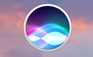
Activating Siri on MacOS Sierra
In case you've recently installed MacOS Sierra, or if you would like to have a hands-free way to activate Siri on your Mac, here's how you can do that.
Apple allows game emulators with outside sources of ROMs
Unlike the earlier moves of this sort, this time it's not a forced decision.
Apple puts a spotlight on work-related Vision Pro use cases
Vision Pro is here to stay. Apple showcases how companies are using the set for purposes other than entertainment.
Life-saving: Apple seeks to patent an anti-drowning feature
Apple Watch was never designed to be just a device telling time. Its maker continues to extend the list of what the watch is capable of.
Apple’s got a patent for ultra-accurate tracking system
Apple knows how to innovate and disrupt, with iPhone being probably the best manifestation of this ability. Now it aims at gesture-based control.