Ascent allows runners, hikers and cyclists to manage and thoroughly analyze their activities with the help of GPS recorded data. The application can store an impressive range of activity data, from heart rate to the equipment used. It uses all this information in order to generate dynamic graphs and textual analysis.
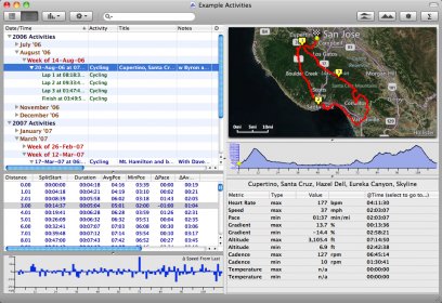
Ascent automatically retrieves data from different types of file formats: *.hst, *.tcx, *.fit, *.gpx, *.hrm. Using this data, the utility will populate activities within a calendar view. Alternatively, you may input data manually with details regarding the duration of the activity, type, altitude, speed, cadence or weather.
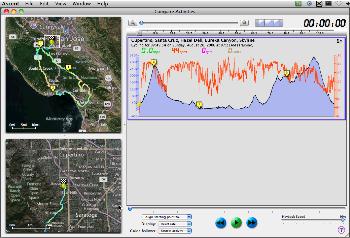
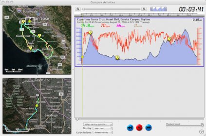
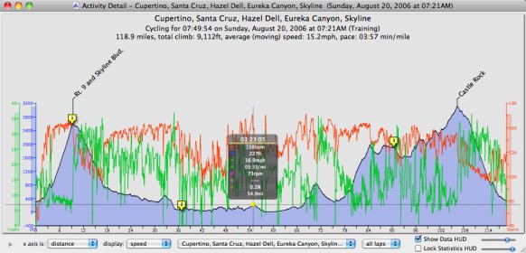
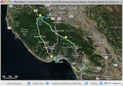
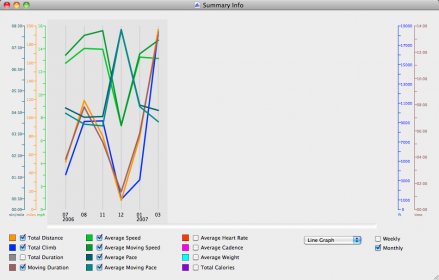
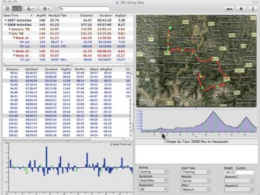
Once an activity has been entered, Ascent uses different methods for interpreting the data: Activity Graph, Activity Data, Detailed Map, Summary Info, Equipment Log, Compare activities, etc. With the help of an interactive map, users can go through all the path checkpoints and metric values specific to that particular coordinate.
Please note that update to the latest version is done from within the program.
Ascent is an ideal time tracking tool that uses GPS data in order to analyze cycling, running or hiking activities; the downside however is that not everyone owns a GPS device and manually adding data may be too time consuming.

Comments