Mac
Mac
Windows
Log in / Sign up
Mac
›
Tags
›
gis interface
Featured
GIS Interface
Software
Relevance
Popularity
Rating
Qgis
free
1,496
Qgis
Qgis is a geographic tool that allows professionals to easily create and manage...
wrapped in a neatly crafted
interface
, that has a modern look
GRASS-
free
90
GRASS Development Team
Commonly referred to as GRASS, this is a free Geographic Information System (GIS) used for geospatial data management...
a free Geographic Information System (
GIS
) used for geospatial
GPSy X
24
Karen Nakamura
GPSy X ® is a sophisticated Macintosh GPS communications and GIS mapping program...
Macintosh GPS communications and
GIS
mapping program. GPSy connects
gplates
free
23
jboyden, jclark
GPlates is desktop software for the interactive visualisation of plate-tectonics...
reconstructions, geographic information system (
GIS
) functionality
AEJEE
free
15
ESRI
AEJEE Screenshot of hurricane tracks ArcExplorer Java Edition for Education (AEJEE) is a downloadable...
Blog Free Desktop
GIS
...a downloadable, lightweight
GIS
tool for exploring geographic
OpenOSX Grass
free
14
OpenOSX
It is a complete GIS...
GRASS
GIS
(Geographic...complete Geographical Information System (
GIS
) with raster, topological
CityEngine
7
ESRI
Esri CityEngine is a stand-alone software product that provides professional users in architecture...
architecture, urban planning, entertainment,
GIS
and general 3D content
LandSerf
free
5
Jo Wood
LandSerf is a freely available Geographical Information System (GIS)...
Geographical Information System (
GIS
)...analysis, gaming development,
GIS
file conversion, map
OpenJUMP
free
3
Michael Michaud
OpenJUMP is an open source Geographic Information System (GIS) written in the Java programming language...
Geographic Information System (
GIS
)...OpenJUMP features: - Vector
GIS
(that can
GeoSymbolsCvx
free
3
R. W. Allmendinger
GeoSymbolsCvx converts a file with Strike and Dip (or trend and plunge) information into a text...
9/X/12/14/15 as
GIS
objects for plotting accurately
DUnet
free
2
University of Denver
DUnet is a public printer (GIS lab) program for Macintosh. This program installs the Dunet printers and printing...
DUnet is a public printer (
GIS
lab) program for Macintosh
gvSIG-
free
2
GVA
gvSIG is a tool oriented to manage geographic information, an integrated Geographic Information System (GIS)...
Geographic Information System (
GIS
) and Spatial...by a user-friendly
interface
, with a quick access
ArcExplorer
free
2
ESRI
ArcExplorer—Java Edition for Education is a new version of ArcExplorer built primarily to support the Macintosh OS X...
ArcExplorer is a lightweight
GIS
data viewer...a variety of basic
GIS
functions, including display
Interface Creator
1
interfacecreator
Dig web interface——在線dns查找工具
1
Google
SpryMedia | User interface design and development
1
Google
STEPS_ENTWICKLUNG_(Interface)_(Img2icns)
Shiny Frog
Talent Media Interface
VLC Remote Interface Widget
free
Craig
1
2
3
4
5
6
7
8
…
20
Tags
Arcims Services
Data
Geographic
Geographic Information System
Geospatial Foundation
Geospatial Information
GIS
Map Viewer
Print File
Visualisation
Featured stories
See all
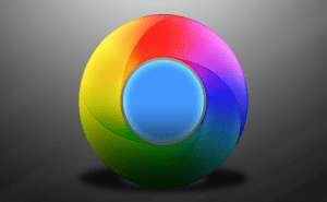
Chrome might get a Material Design-style interface
Judging by the new tab and address bar design sported by Chrome Canary, Google may be getting ready to spruce up its web browser's visual interface using Material Design elements.
Apple allows game emulators with outside sources of ROMs
Unlike the earlier moves of this sort, this time it's not a forced decision.
Apple puts a spotlight on work-related Vision Pro use cases
Vision Pro is here to stay. Apple showcases how companies are using the set for purposes other than entertainment.
Life-saving: Apple seeks to patent an anti-drowning feature
Apple Watch was never designed to be just a device telling time. Its maker continues to extend the list of what the watch is capable of.
Apple’s got a patent for ultra-accurate tracking system
Apple knows how to innovate and disrupt, with iPhone being probably the best manifestation of this ability. Now it aims at gesture-based control.