Develop geography maps of different regions. Add custom markings to specify the elements and areas on the map to pay attention to. Generate entire presentations by combining several local maps of different scales to get the full picture of the region.
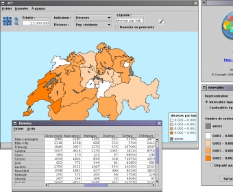
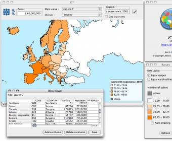
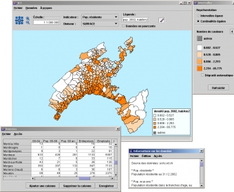
JCT draws and edits thematic maps. It is primarily intended for geography teachers and their pupils.
Comments