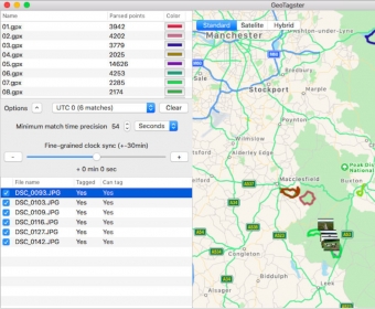
Simple, robust and super fast geotagging using you GPX files.
Load your RAW or JPG photos and your GPX files and enjoy fast automatic tagging with latitude, longitude and altitude (if available).
View your GPS route on the built in map and verify if the time offset is correct, adjust the time offset if your camera is not synchronised with your gpx track.


Comments