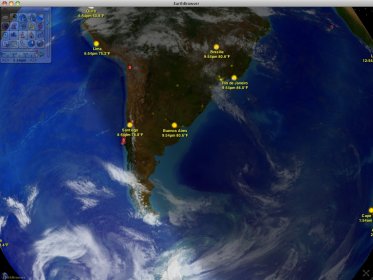
Earth Browser is an Earth simulator that combines imagery and real-time data. It is made in Adobe AIR, so you can install this app in Windows, Mac OS X, and Linux. Earth Browser uses satellite imagery to create a 3D view of the Earth. You can zoom in and out, but the detail of the satellite maps isn't as good as Google Earth, for example. In other words, you can't zoom all the way down and see buildings and landmarks. You might be able to zoom in more in certain US and Europe locations than other countries.
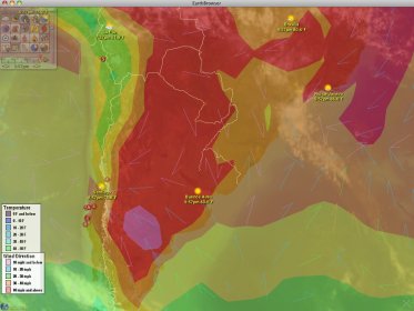
By default, Earth Browser only shows the satellite map and some data like recent earthquakes, city names, etc. What is great about this app is that you can add more layers to the map. For example, you can enable country borders and state borders (US only), temperatures, wind direction and speed, satellites, panoramio pictures, and others. Thus, it is easy to find out if there are clouds near your city or what the temperature is or is going to be in the near future. Of course, you can't always trust these apps with the weather info. But from what I have seen it was very accurate. If you live in the US, you will also get access to a Doppler radar.

Comments (1)