PostGIS adds support for geographic objects to the PostgreSQL object-relational database. In effect, PostGIS "spatially enables" the PostgreSQL server, allowing it to be used as a backend spatial database for geographic information systems (GIS), much like ESRI's SDE or Oracle's Spatial extension. PostGIS follows the OpenGIS "Simple Features Specification for SQL" and has been certified as compliant with the "Types and Functions" profile. There are now several open source tools which work with PostGIS. The uDig project is working on a full read/write desktop environment that can work with PostGIS directly. For internet mapping, the University of Minnesota Mapserver can use PostGIS as a data source.


Compact version of Navicat which provides basic and necessary features you will need to perform simple administration on a database.

Powerful yet easy-to-use PostgreSQL graphical interface that provides extensive functionality for managing and developing PostgreSQL database.
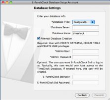
Remote Database Setup Assistant makes it easy for you to setup a database.


Comments