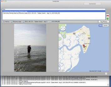
Longitude uses user's own Latitude service's geo information to geotag JPEG (no RAW support at the moment) images using time correlation information. Mainly to be used when using professional DSLRs or older cameras with no geotagging capability.
This is the first version, and currently only works with JPEG images (which is the majority in use). Future versions may add features and change in pricing.
Comments