Create, edit, visualize, analyse and publish geospatial information.
Plan routes, calculate distances or search points of interest.
Application that displays the GPS coordinate embedded in photos.
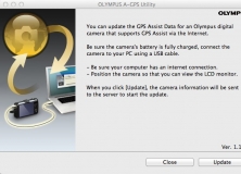
Download the latest Assisted GPS data.
Smart mapping system for Mac computers.