Plan routes, calculate distances or search points of interest.
Application that displays the GPS coordinate embedded in photos.
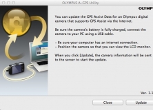
Download the latest Assisted GPS data.
Transform your photos into paintings.
Generate deed plot maps using metes and bounds data.