GeoTriple for Geospatial Imagery screenshots

Provides a collection of state-of-the-art geosciences software solutions.
GeoTriple for Geospatial Imagery 2.0 : Main image

Alternative downloads

Qgis
Free
rating

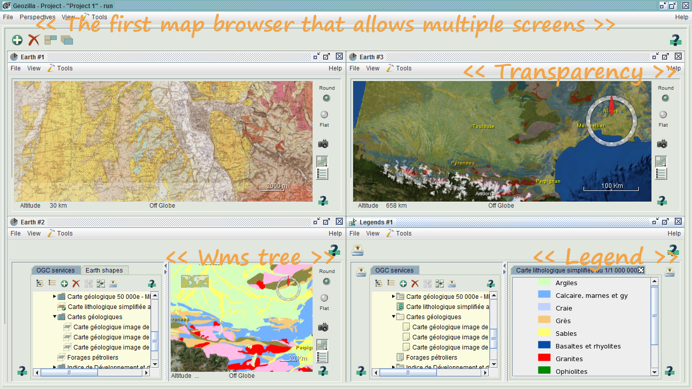
Create, edit, visualize, analyse and publish geospatial information.

Shapes
rating

Easily create charts and model relationships on your Mac.

Marathon Red
Free
rating

TC scenario for Marathon Infinity.