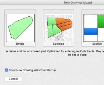
Metes and Bounds lets you generate deed plot maps using metes and bounds data. Although the developer has done the best to make this application as easy to use as possible, it is not one of those tools you can start to use right away without any help. That is probably why it comes with lots of documentation in the form of tutorials and user guides. Besides, the effort to flatten the learning curve by means of wizards is also appreciated.
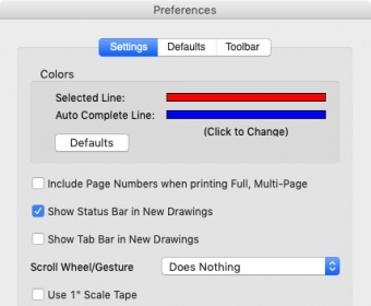
Even though the application supports using multiple measurement systems, the Imperial system appears by default, and, unfortunately, setting the app to use any other system should be made less intricate. Still, its support of obsolete units of measurement, such as rods, chains and spans, makes it appropriate when the source document or map is very old.
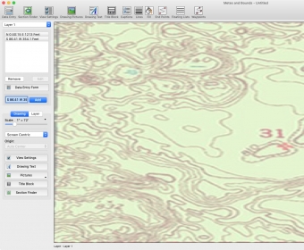
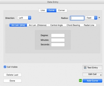
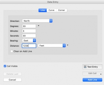
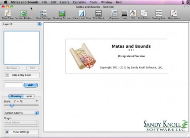
It is great that Metes and Bound supports layers, which lets you manage and view different information independently. There is also the possibility to merge various layers into a single one. A good idea is to start by creating a layer and loading a map image to serve as a background. Then, you can begin to enter data by different means to plot curves, lines and section calls. In this respect, the most frequent way is through the Data Entry Form; yet, you can also use the word processor style entry or the call drawing tool. Luckily, it is possible to use GPS data.
Various tools can boost your productivity by freeing you from manual calculations. For instance, there is a built-in calculator to calculate the perimeter and area of a plot. Likewise, you can use it to detect closing errors. Similarly, the tool can complete missing segments automatically and calculate distances between points.
In general, Metes and Bounds is mostly intended for real estate agents as it can convert any data about metes and bounds into more readable maps. Luckily, the product can be used for free without time limits; but most of the advanced features will not be available. There are also two paid versions Basic and Pro.

Comments